Satellite images reveal forests at risk – could technology help stop bark beetle damage
Satellite and aerial images can be used to map tree health over vast areas and to direct forest owners’ attention to forests at risk.
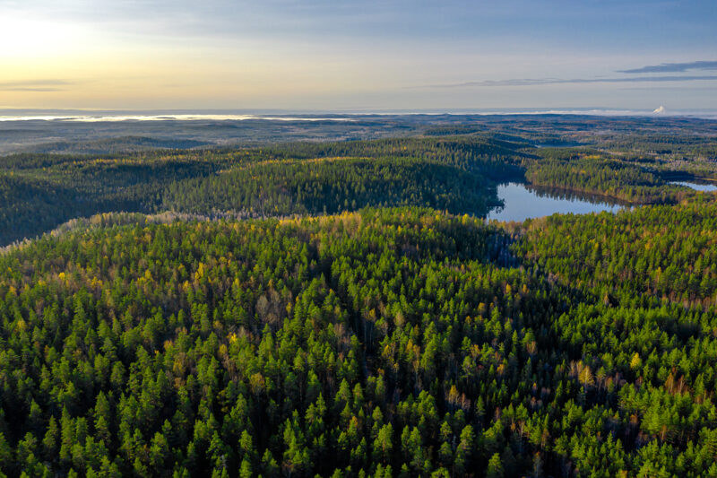
The ever more detailed satellite images can reveal groups of damaged trees and even single dead trees. These can be a sign of forest damage, and the earlier it is detected, the better it can be prevented from spreading.
In recent years, forests in Europe have been scourged by the spruce bark beetle. This small insect, less than half a centimetre in length, has caused widespread destruction in German spruce forests, for example, and even farther north the risk of damage is increasing.
’The aim is to stop the damage before it expands into a massive disaster, such as we’ve seen in Central Europe,’ says Lauri Haataja, interviewed by Audiomedia.
Haataja is the project manager in a project by the Finnish Forest Centre designed to improve the detection of forest damage. Within the project, the Forest Centre has started using satellite and aerial images to monitor and prevent forest damage.
’Traditional monitoring and field visits have sometimes been insufficient, if and when forest damage occurs over large areas and the forest owners are not there to monitor their forests. Using satellite and aerial images to monitor forest damage has become a new and effective tool,’ Haataja explains.
Satellite images reach an accuracy of half a metre
Satellite images have also been used to monitor forest damage in Germany, Austria and the Czech Republic. Haataja says that a new imaging method with a higher resolution has been developed in Finland.
According to the Finnish Forest Centre, the most detailed satellite images in use have an accuracy of fifty centimetres. However, this level of detail is costly, and satellite images available free of charge often have an accuracy of ten metres.
More accurate images, says Haataja, make it possible to observe in detail the health of forests over larger areas than would be possible otherwise. On the other hand, satellite images rarely help in determining the cause of damage; for this, monitoring and visits on the ground are needed.
Haataja believes that in future, it will be possible to respond to forest damage more rapidly, thanks to the continued development of satellite technology and the remote sensing enabled by it, and to the increased accuracy of data.
’It’s possible that satellite images will eventually be used to monitor even larger areas and that they can be used with more and more sophistication to detect the many different causes of forest damage, such as windfalls, root rot and other natural phenomena.’
Latest data must reach the forest owner
The satellite images are analysed by the Finnish Forest Centre’s partners, including KOKO Forest Oy and Sitowise Oy.
’The images are used to create a set of point data showing the exact location of dead trees. The data is transferred to the Forest Centre systems, through which forest owners can find out about the potential risks to their forests,’ Haataja says to Audiomedia.
Transmitting the data from the satellite images to forest owners is necessary for the prevention of forest damage.
Most of Finnish forests are owned by private individuals, numbering almost 600,000. More and more of them live far away from their forests, and there is an increased need to generate data on forest health.
’If you don’t live close to your forests, you’re less likely to monitor their health. Using satellite images makes it possible to monitor large areas comprehensively, so the forest owners themselves need not visit their forests for this,’ Haataja says.
’The images can be used to create a map based on geospatial data, and this will give visual information on forest health.’
The map and any data derived from it are sent to forest owners via the Metsään.fi service of the Finnish forest Centre. The service is free of charge to forest owners and allows them to review the data on their properties, to receive suggestions for forest management and, for example, apply for available public aid for forestry.
Haataja points out that the service also contains instructions on how to examine the condition of your forest and what to do if signs of forest damage are detected.
Read more: Drones bring in forest data that used only to be dreamed of
Read more: Use of AI in the forest sector illustrated in six images