
Peatlands are a vital carbon storage. Taken together, the world’s peatlands store almost one third of the carbon bound in soil. When peatlands are drained through ditching, the carbon storage in them is released into the atmosphere.
Peatlands are restored by blocking the drainage ditches, which will cause the water table in the peat layer to rise so that the site will return to a state close to natural. After restoration, the water table of the site must be monitored to ensure the success of the operation.
Visiting inaccessible and treacherous peatland sites is, however, cumbersome and slow. What is more, data must be gathered across considerable areas over several years, for after the restoration change is slow.
In collaboration with an international research team, Aalto University has developed a mew remote sensing method which will enable a more rapid and accurate monitoring of the success of peatland restoration.
’Satellites used for remote sensing can observe extremely large peatland areas across the world. Satellites normally orbit the Earth for several years and always image the same areas, sometimes even weekly, and so the changes in peatlands can be monitored in great detail and as long time series,’ says Professor Miina Rautiainen, in charge of the international remote sensing study, in a press release by Aalto University.
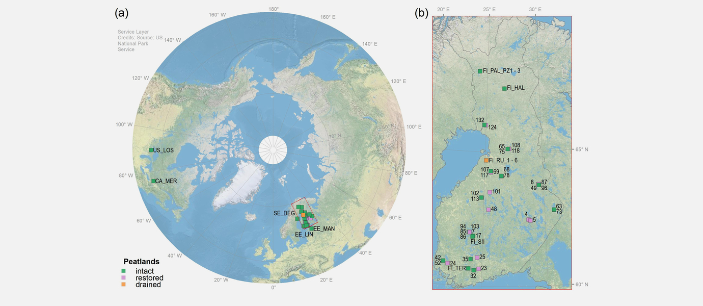
The remote sensing method used in the study was OPTRAM (Optical Trapezoid Model), with open-source satellite images taken by the Sentinel-2 satellite of the ESA. The study included 53 peatland sites in Finland, Sweden, Estonia, the United States and Canada.
The satellite images were used to create multi-year time series of the groundwater tables on the sites. The results were compared with field readings, which were made over three years on all 53 sites. The sites included both natural, drained and restored peatlands.
The method has been published as an open-source calculation code and is thus available to all users. By now, the method has been tested in studies of tropical peatlands in Indonesia, Malaysia and the Amazon. The method makes it possible to monitor the water tables week by week throughout the growing season or the snowless season.
’We hope that the method will be used in peatland restoration and in monitoring its impact. Peatland water tables are a direct indicator of the success of restoration,’ says Rautiainen.