FAO’s forest monitoring revolution is rooted in Finnish open-source expertise
Fifteen years ago, a Finnish-funded development project began reshaping how the world monitors its forests. Today, that initiative has evolved into Open Foris, a global suite of open-source technical solutions developed by the Food and Agriculture Organisation of the United Nations (FAO), now used in over 190 countries.
“The idea was to build tools that anyone could use without license fees—freely available to governments, students, and researchers alike. It’s based on equality and openness, values deeply rooted in Finnish culture,” says Anssi Pekkarinen, head of the FAO’s Global Forest Resources Assessment (FRA) Programme.
Pekkarinen, who began his career at the Finnish Forest Research Institute and later joined the European Commission’s Joint Research Centre, brought a strong commitment to Linux and open-source principles when he joined FAO in 2009 to find a group of like-minded experts.
That ethos laid the foundation for a global shift in forest monitoring—tools that are accessible, adaptable, and transparent.
The first Open Foris tool, the Geospatial Toolkit, was a set of command-line utilities designed for the Linux operating system. It was later complemented by Collect, a tool for field data collection, and Calc, which supports statistical analysis and reporting.
The team also developed a prototype for a solution that became the most widely used Open Foris application—Collect Earth, an extension of Google Earth. This enabled visual interpretation of forest changes via satellite imagery. Gradually, these desktop applications have evolved into more sophisticated solutions and expanded into cloud-based processing and analysis platforms such as SEPAL, Open Foris Arena, and Collect Earth Online.
The success of Open Foris drew in lots of users, new tools, and global interest—along with support from new countries like Germany, Norway, and the UK. Currently, Open Foris is supported through a partnership between the United Kingdom and the FAO called Accelerating Innovative Monitoring for Forests (AIM4Forests) and through support from Norway’s International Climate and Forest Initiative for the SEPAL platform.
“These innovative solutions have helped democratise forest data, making monitoring more collaborative and cost-effective,” Pekkarinen explains.
Solutions for Every Forest Type
Open Foris has demonstrated that technology and innovation can be a great equaliser, especially when it is free, open and inclusive. Today, the platform has more than 250,000 users across 196 countries, according to Julian Fox, FAO’s Forest Monitoring Team Leader.
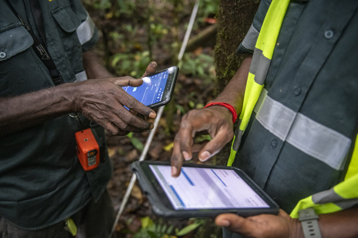
The platform supports both ground-based inventories and remote sensing. For example, Arena Mobile allows field teams to digitally record tree measurements, replacing handwritten notes with centralised, analysable data.
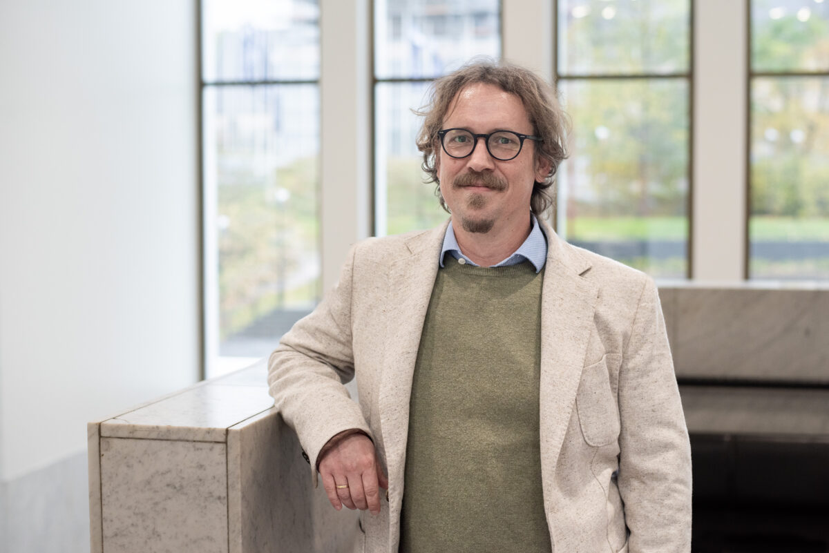
“You can go into the forest with a tablet, set up a survey, collect data, and immediately generate statistics. It’s all digital and centralised,” explains Andreas Vollrath, FAO Forestry Officer.
However, despite advances in artificial intelligence, visual interpretation remains essential.
“Even with all the algorithms, some things still require human eyes. But AI is catching up fast,” Vollrath says.
“Newly generated datasets and models that integrate measurements from various data sources resemble a virtual constellation of multi-sensor satellites in the form of so-called embeddings. This approach allows access to the wealth of remote sensing data more easily and already helps identify various types of forest dynamics around the globe more quickly and accurately,” he adds.

Finland’s Lasting Impact
With Finland providing the foundation for Open Foris, which has now grown into the mature Open Foris platform of 2025, its influence continues. In addition to early funding and technical leadership, Finnish companies like ICEYE continue to shape the future of Earth observation with radar satellite constellations.
In September 2025, ICEYE signed a €158 million agreement with the Finnish Defence Forces to deliver the country’s first domestically sourced satellites for defence use. The contract includes Synthetic Aperture Radar (SAR) satellites and ground infrastructure, significantly boosting Finland’s space-based surveillance capabilities.
Earlier during the year, ICEYE expanded its fleet with four new SAR satellites, further strengthening its global imaging capacity. SAR technology enables precise, high-resolution imaging regardless of cloud cover or darkness—an essential feature for both national security and environmental monitoring.
“ICEYE’s radar tech is unique. It can see through clouds and at night—which is incredibly useful in forest monitoring,” says Andreas Vollrath of FAO. He also highlights Finland’s strong tradition of ground-based inventories, still regarded as the gold standard in Nordic forestry.
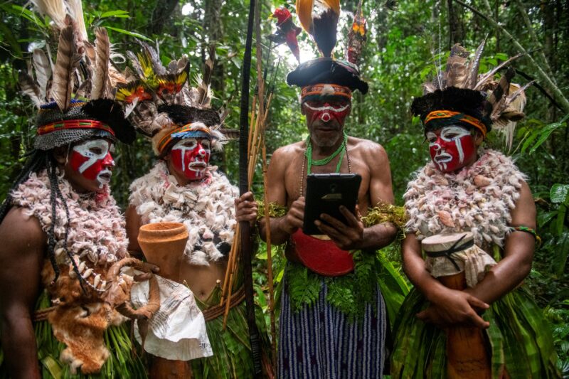
Papua New Guinea offers a compelling example of Open Foris in action, Vollrath notes. The country has integrated tools like Collect Earth and SEPAL into its National Forest Monitoring System (NFMS), enabling more accurate tracking of deforestation and forest degradation.
These tools support international climate reporting, including REDD+ submissions to the UNFCCC, and have helped build local capacity.
“Through targeted training, forest officers and local communities can gain the skills to interpret satellite data and actively shape national land-use planning,” Vollrath says.
“By pairing open-source technology with real-time analysis, PNG has improved transparency and its ability to respond to forest threats.”
Forests, Finance, and the Future
FAO’s priorities for the coming years include helping countries meet climate reporting obligations, improve greenhouse gas inventories, and access climate finance, such as through Brazil’s proposed Tropical Forest Forever Facility (TFFF). The $125 billion fund, expected to be launched at COP30 in Belém in November, will reward countries for keeping tropical forests intact.
“It’s a new mechanism that simplifies conservation and restoration funding. Countries can use remote sensing to monitor and report forest area and unlock investment transparently—not just donor aid,” Vollrath explains.
In an era of environmental scrutiny, trust in forest policies depends on transparent, verifiable data. That’s where Open Foris excels.
“All our code is on GitHub. Anyone can inspect it. That openness builds confidence in forest policies and their implementation,” says Vollrath.
By standardising inventory methods and making them globally accessible, Open Foris helps governments produce consistent, comparable data—essential for climate reporting and finance, and policy evaluation. The solutions also support real-time monitoring, enabling faster responses to illegal deforestation and more transparent communication with the public.
“If countries use these solutions, you know they’re relying on something open, tested, and visible. That definitely builds trust,” Vollrath adds.
A Data-Driven Future
With petabytes of satellite data arriving daily, the challenge now is extracting meaningful insights. Embedding models—AI systems that compress and organise vast datasets—are one promising frontier.
“You could see a patch that’s been deforested, mark the area, ask the model to identify similar spots and get back the results almost instantaneously. It’s incredible how this technology simplifies the way we interact with very complex and immensely huge data,” says Vollrath.
These models integrate radar, optical sensors, LiDAR, and even geotagged Wikipedia entries to recognise patterns across ecosystems. FAO is exploring how AI can support restoration verification, forest extent mapping, and deforestation alerts—especially in tropical regions where field access is limited.
Still, Vollrath emphasises that AI at this stage complements rather than replaces traditional methods.
“Remote sensing–based AI tools are excellent for retrieving key variables of forest ecosystems at scale and in a timely, cost-effective manner. However, the quality of their output depends heavily on the data they are fed,” Vollrath points out.
He continues that certain variables are difficult, or sometimes impossible, to measure accurately from satellite imagery alone.
“While remote sensing gives a big-picture view of forests, combining it with field measurements helps us understand them more deeply—leading to improved and more holistic conservation management efforts.”