Digital twin of forests commissioned by European Space Agency – new tools for carbon calculations are hoped for

A digital twin of forests allows an increasingly comprehensive modelling and prediction of the development of forests. The first models will be created of forests in Finland, Germany and Romania – to be followed by all forests in the world.
A few years ago, digital twins hit the news as the hottest trend in the IT world. Articles on digital twins were illustrated with virtual models of sports cars and cranes, but twins had reportedly been made of entire factories and towns as well.
A digital twin is the virtual model of an object. The data gathered by it enables real-time testing and product development, among other things. Digital twins make use of such systems as the internet of things, and they can be used to anticipate events in the real world.
The European Union plans to utilize digital twins on an unprecedented scale, aiming to create a digital twin of the entire Earth. The twin would monitor, predict and visualise what both humans and nature are doing on our planet. The background to this plan is formed by the European Green Deal and its sustainable economy aims.
The Digital Twin Earth project begins with the modelling of several different areas. In addition to forests, digital twins will be created for food systems, climate, hydrology, oceans and Antarctica, for example.
Users hope for data on carbon storages
At the moment, a prototype version of the digital twin of forests is being constructed. The work was commissioned by the European Space Agency ESA and is led by VTT Technical Research Centre of Finland. Other partners include the University of Helsinki, the Romanian Forest Research and Management Institute and companies from Germany, Poland and Finland.
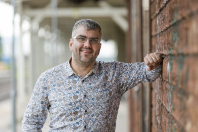
But what will the digital twin of a forest look like? That is something that even Matti Möttus, Principal Scientist at VTT, does not yet know.
’In the course of this work we’ve started, the digital twin of a forest evolves continuously. The objective is to create data-based tools that are as easy to use as possible, to monitor the condition of forests and examine future options,’ says Möttus.
The end result will also depend on the needs of its users. Researchers, decision-makers and business operators were asked how they could see themselves utilizing the digital twin, and one thing that came up in all replies was the forest carbon storage.

In addition to showing changes in the forest carbon storage, the digital twin can be used to model and predict such things as the increase of timber stock and the health of trees on the basis of changes in forestry operations or the climate.
’I hope we can construct a tool that helps reveal on a larger scale how forests affect the climate and the living environment, and what changes forests are undergoing,’ Möttus says.
Visualisation is an enormous challenge
In recent years, modelling forests has been fairly popular. Various 3D and virtual forests have been created for companies and research institutions. They can be used by forest owners and experts to test and compare the effect of different forestry measures over shorter or longer periods.
The virtual models are normally based on data on forest resources, gathered by remote sensing from an aeroplane, from satellites and by on-site visits. The models make use of geographic data to ensure that forest paths and streams are correctly situated and terrain contours correspond to reality.
The digital twin by ESA and VTT is different from more local virtual forests in terms of its focus and the technology used for data gathering. Satellite images are used to model the forests. In addition to forest data, important input includes weather data and climate scenarios.
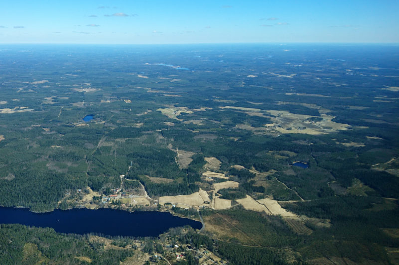
The prototype of the digital twin of forests is based on three areas, located in Finland, Baden-Württemberg in Germany and Romania. The size of the German and Romanian areas is 100 x 100 kilometres. In Finland, the area is located in the vicinity of the Hyytiälä Forestry Field Station and is 100 x 200 kilometres in size.
Möttus views the digital twin of forests as global and local map data sets, but believes that a 3D virtual model will also be developed that corresponds to reality as closely as possible. While results of the user survey showed that a 3D visualisation was considered the least important element of the twin, Möttus knows that visual material will be needed for educational purposes, for example.

However, a convincing visualisation of forest remains a huge challenge, despite the fact that the game technology used for it is developing by leaps and bounds.
’Forests vary significantly in structure and behaviour. They are much more than just a lot of trees, which makes it challenging to depict them. Changes in forests occur on extremely small and extremely large scales,’ Möttus said when presenting the digital twin of forests project during the ESA Earth Observation Phi Week in October 2020.
Completed in ten years
The consortium led by VTT is scheduled to complete the prototype of the digital twin of forests by the end of 2021. Möttus estimates that the tools included in it will be available to forest companies and others in about ten years.
The enormous scale of the system is illustrated by the themes into which ESA has subdivided the Digital Twin Earth project. The background of forest modelling includes, for example, supporting a carbon-neutral Europe through land use. Another task of the digital twin of forests is to help manage environmental disasters and risks and to strengthen biodiversity and ecosystems.
The development of the twin is supported by two other forest modelling projects by VTT based on satellite data. The Forestry TEP project provides remote sensing data gathered by satellites to estimate, among other things, the amount of carbon bound by forests in various parts of the world both currently and in the future. In the Forest Flux project, satellite images are made accessible to forest companies and forest owners through a service that enables them to improve the profitability of forestry and ensure ecological sustainability.
’We have comprehensive know-how on forest modelling in Finland. Developing the digital twin for ESA is one more element in consolidating the Finnish competence centre for the satellite remote sensing of forests,’ says Möttus.
The project website for Forest Digital Twin Earth Precursor (DTEP)
